

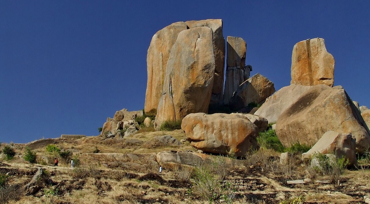
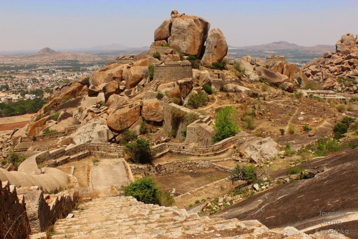
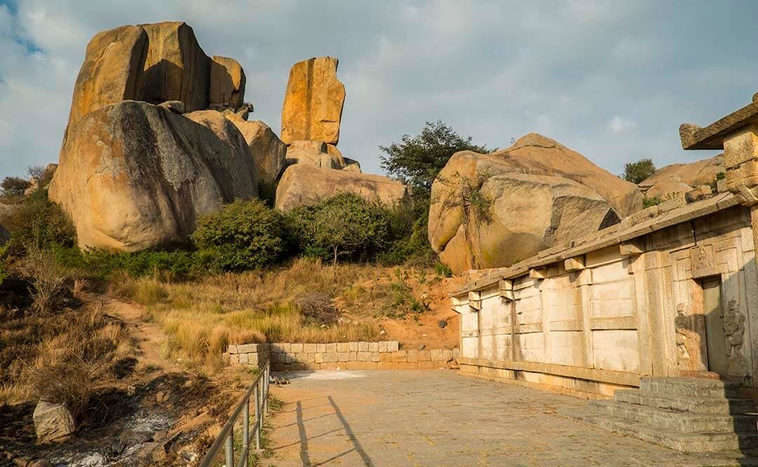
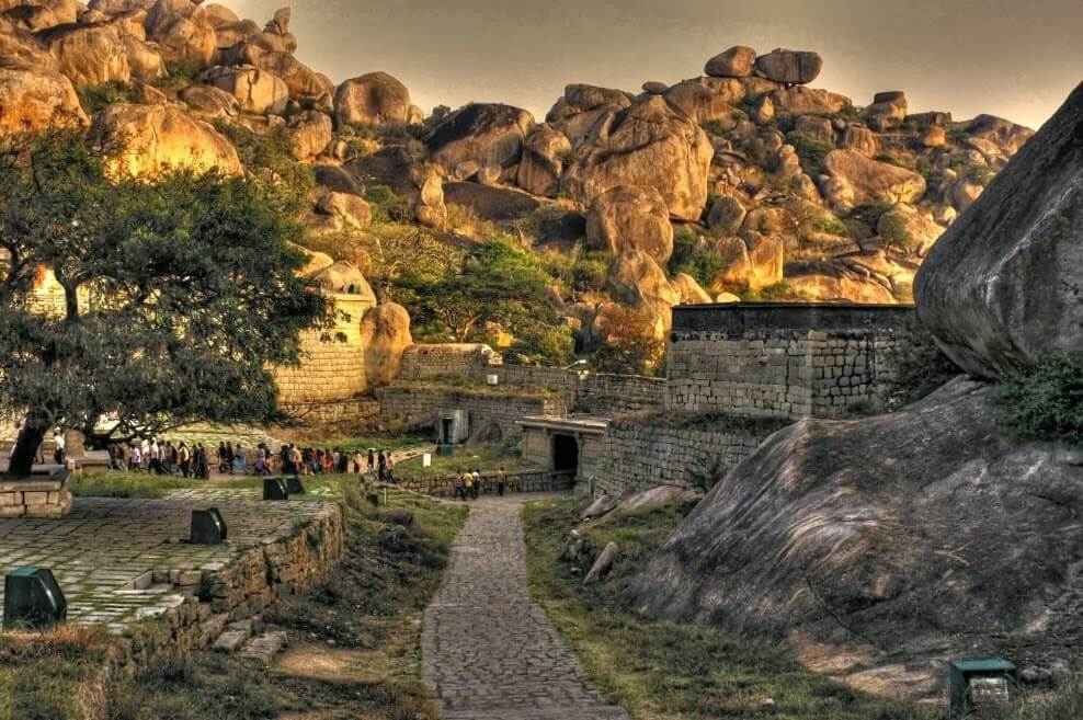
Located in Karnataka, Chitradurga gets its name from Chitrakaldurga, an umbrella shaped rocky hill found here. This city is known for its boulder strewn landscape, which is geologically supposed to be a part of the oldest rock formations in the country. The area is also rich in many mineral deposits and has many gold and copper mines.
Legend
According to a story in the Epic Mahabharatha, a man-eating gaint named Hidimbasura lived on the Chitradurga hill and was a source of terror to everyone around. When the Pandavas came with their mother Kunti in the course of their exile, Bhima had a duel with Hidimba. Hidimba was slain by Bhima and peace returned to the area. Legend has it the boulders were part of the arsenal used during that duel. In fact, the boulders on which major part of the city rests belong to the oldest rock formation in the country.
Histroy
A rock cut edict of Emperor Ashoka, near Bharamagiri reveals that Chitradurga was part of the Mauryan Empire dating to the 3rd century B.C. After the fall of the Mauryans, this land was under the rule of royal dynasties like the Rashtrakutas, Chalukyas and Hoysalas. But it really achieved eminence, as a feudatory state of the Vijayanagar Empire, under the dynastic rule of the Nayakas or “Paleyars”, known for their heroic exploits.
The Fort was built in stages by the dynastic rulers of the region. The Nayakas of Chitradurga, or Palegar Nayakas, were most responsible for the expansion of the fort between the 15th and 18th centuries.
The most eminent of the feudatory chieftains, was Madakari Nayaka, who after the fall of the Vijayanagar Empire, declared his suzerainty and consolidated his power. This hill fortress built by the Nayakas during the Vijayanagar era, became their stronghold later.
In 1779, the fort was captured by Haider Ali, who along with his son Tipu Sultan, was responsible for its expansion and strengthening. After Tipu Sultan’s defeat by the British, the fort came under the rule of the Royal Mysore family.


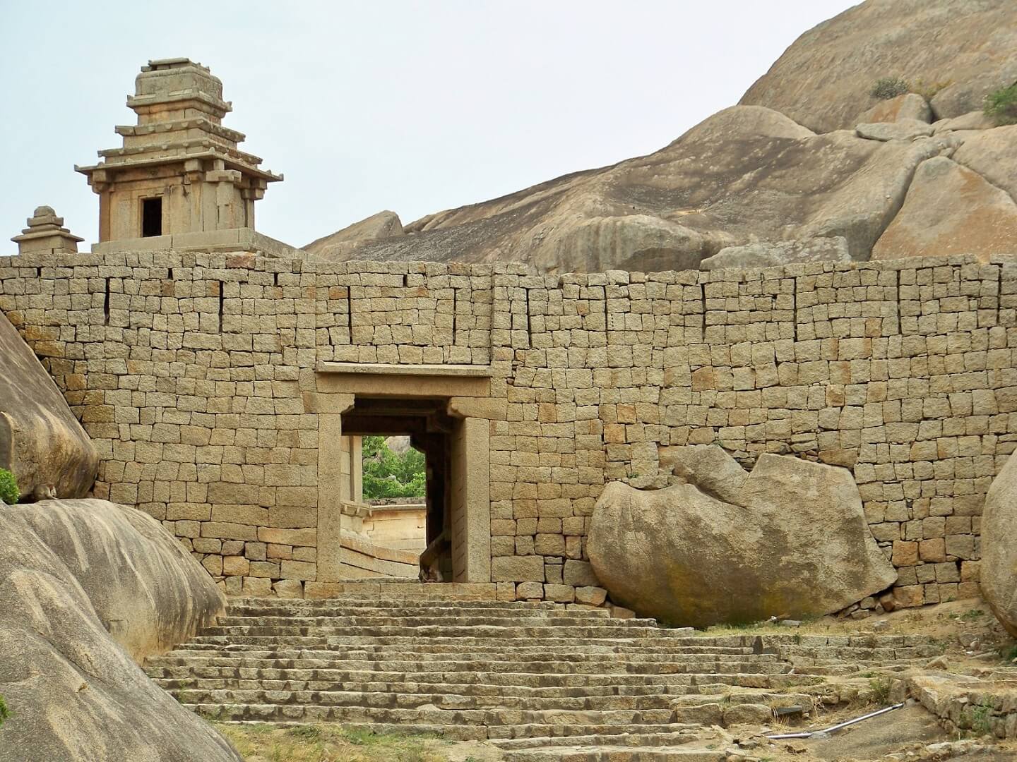
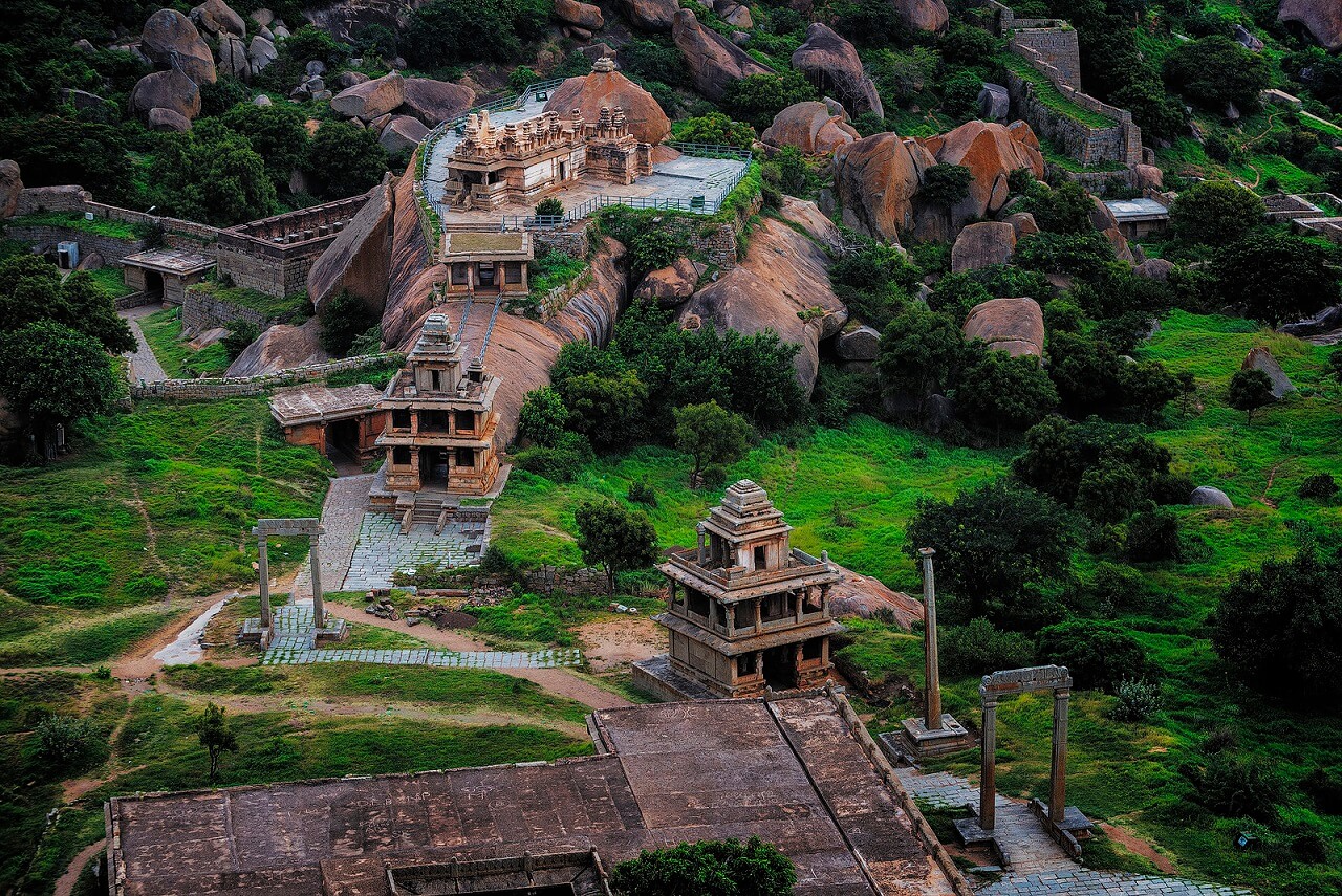
Fort Precincts
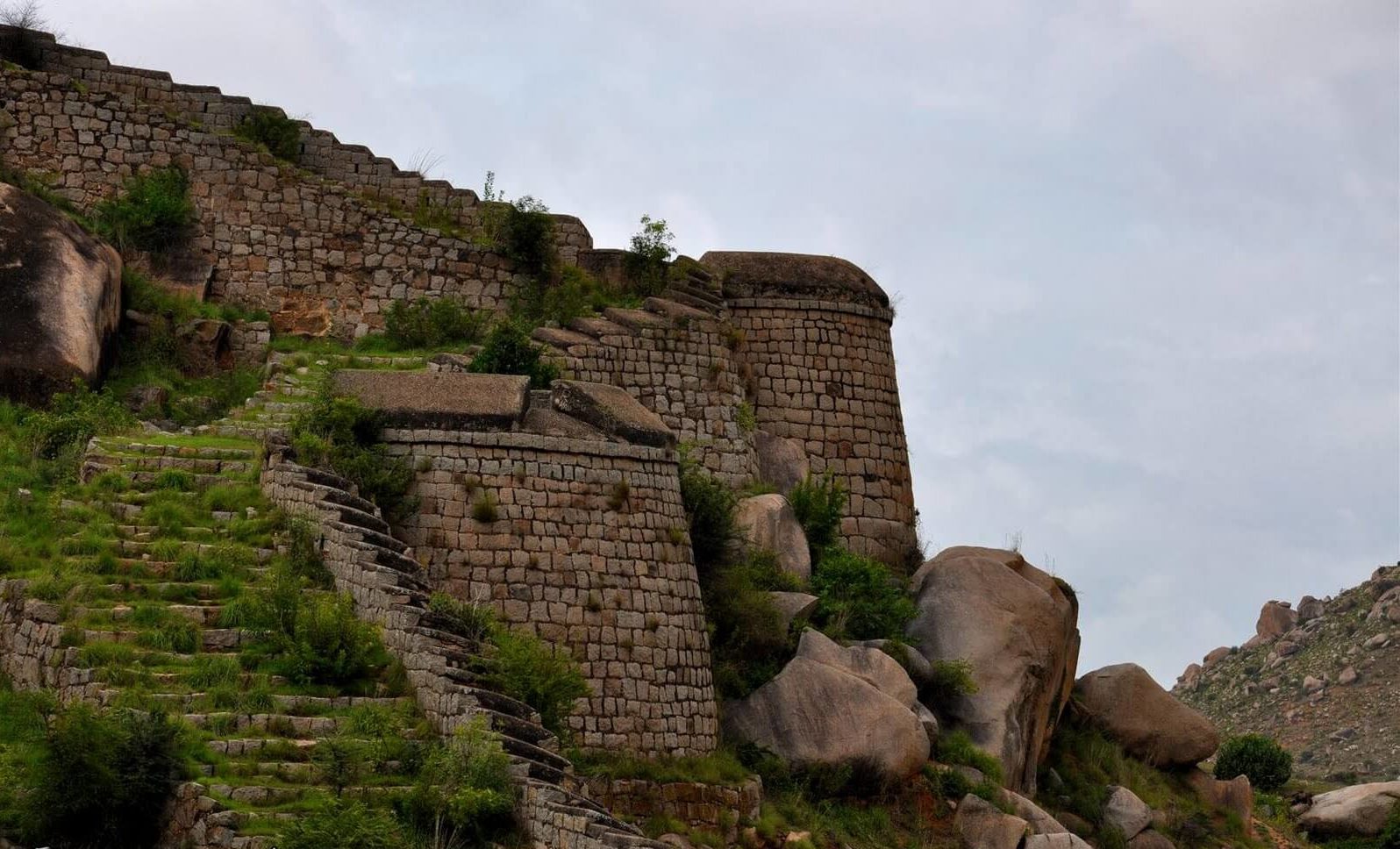
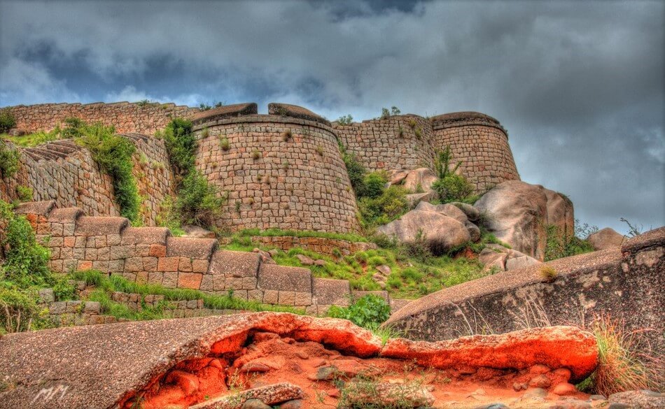
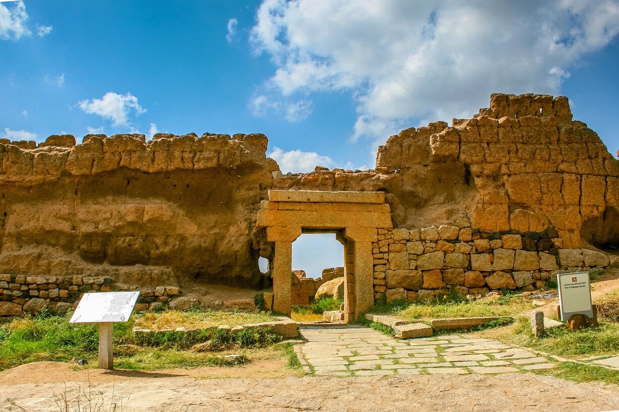
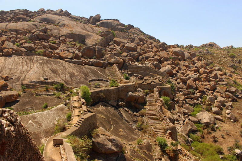
The Nayak Palegars built the fort as an impregnable fortification for defense purposes. It has seven lines of defence with bastions of various shapes at regular intervals of which three are at the foot of the hill and the remaining four over the hill. The outermost wall has four gateways, one on each side.
Zig-zag entrances are provided through these seven lines of fortification with batteries and magazines. The height of the wall of each line varies from 8 to 15 m. At places brick walls of 1.21-1.82 m are also used. The three outer walls of defence are provided with deep broad moats. The fortification once had nineteen gateways, thirty eight postern-gates, thirty five secret entrances.
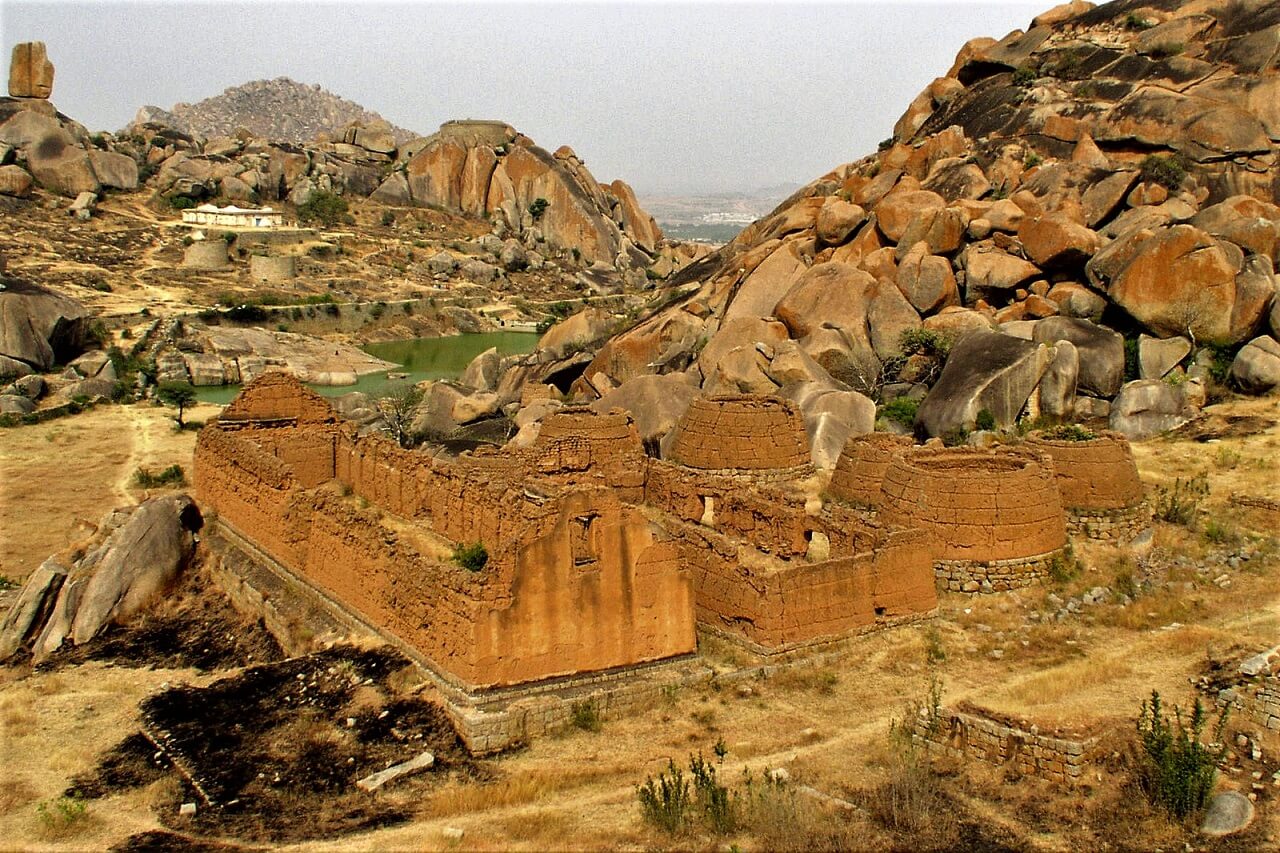
The storage warehouses, pits and reservoirs were primarily designed to ensure the food, water and military supplies required to endure a long siege.
The total length of the fort walls is about 8 kilometres (5.0 mi) and covers an area of about 1,500 acres.
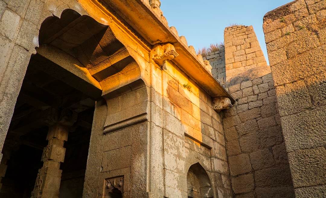
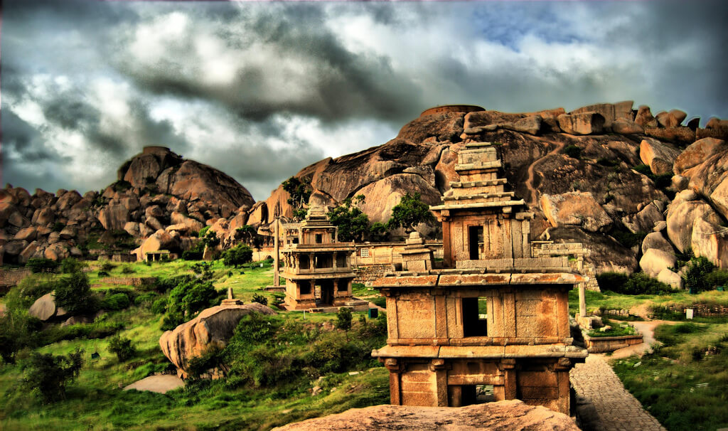
There are 18 temples in the upper fort and one huge temple in the lower fort. Among these temples the oldest and most interesting is the Hidimbeshwara temple. The masjid was an addition during Hyder Ali’s rule.
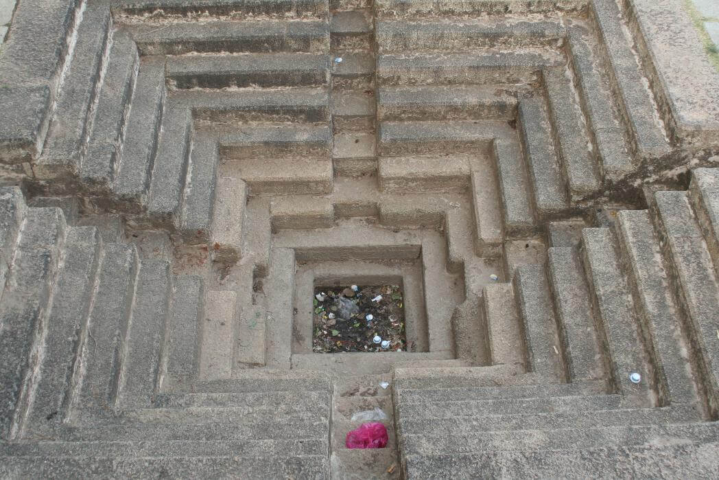
The impregnable Chitradurga fort has an outstanding rain water harvesting mechanism which is still functionable. Rain water-harvesting structures were built in a cascading fashion, which ensured large storage of water in interconnected reservoirs. It is said that the fort precincts never faced any water shortage.

Source: chitradurga.nic.in & ASI Bengaluru Circle